🎉 Up to 70% Off Selected ItemsShop Sale


San Diego Central Region Map - Regions and Neighborhoods - FILES - PDF and AI, editable, vector, royalty free
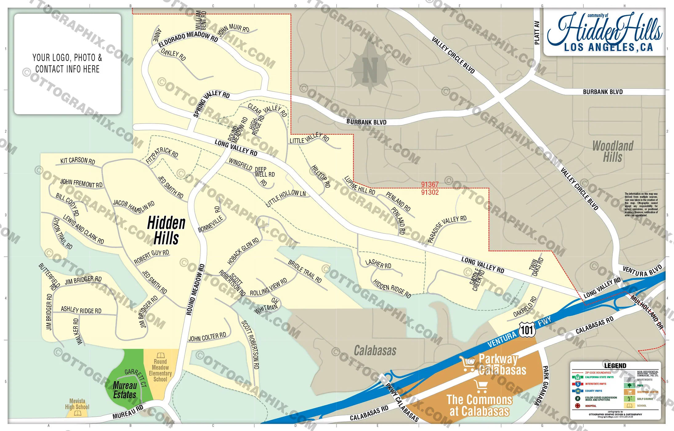
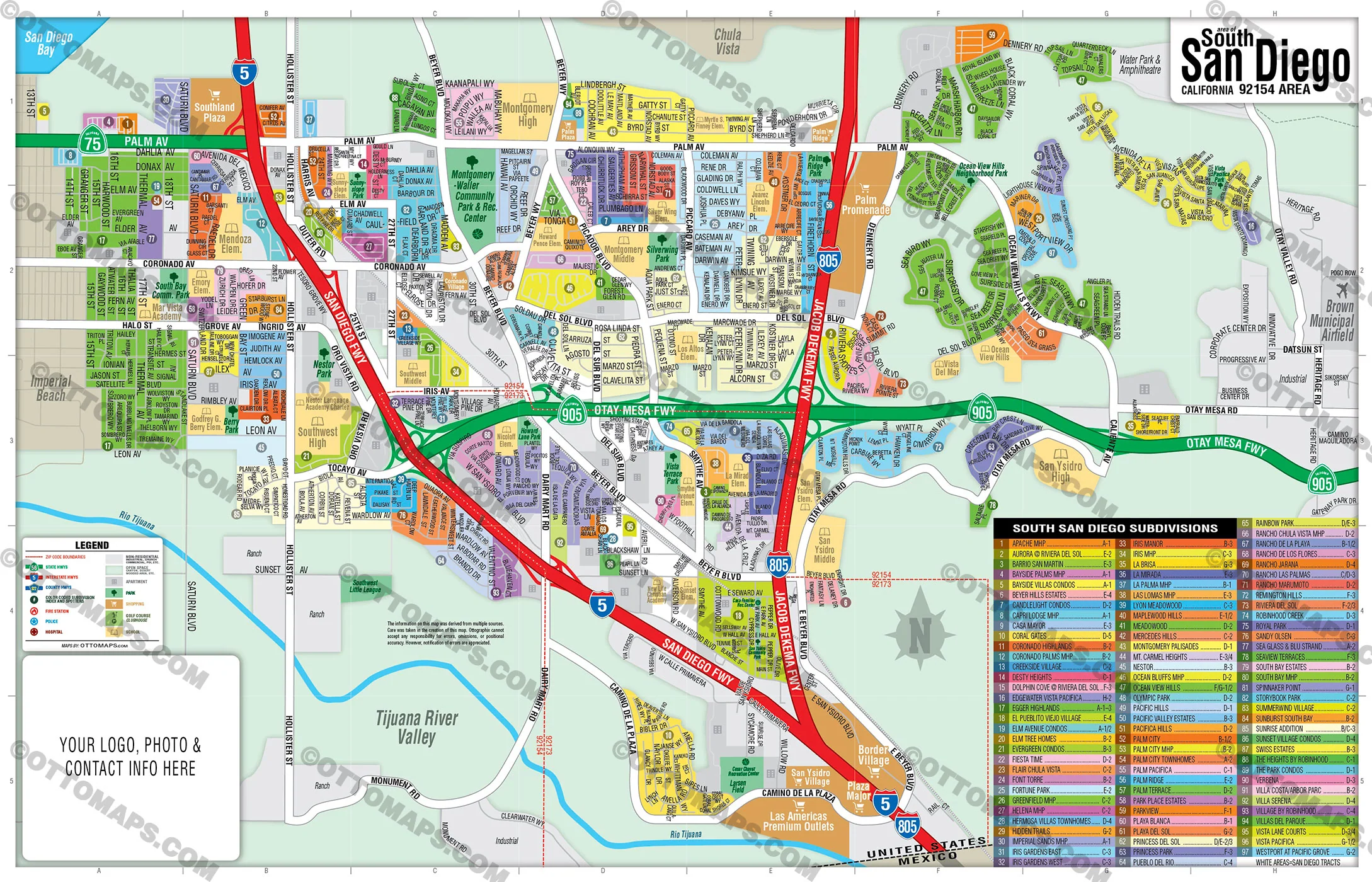
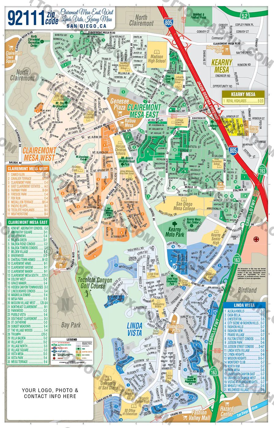
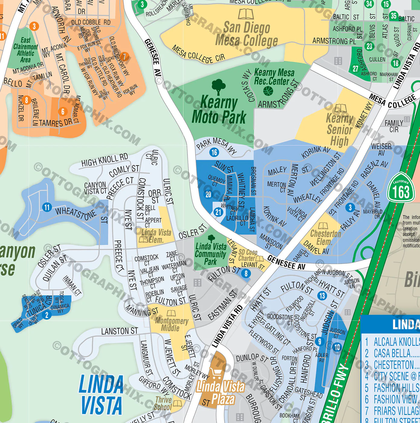
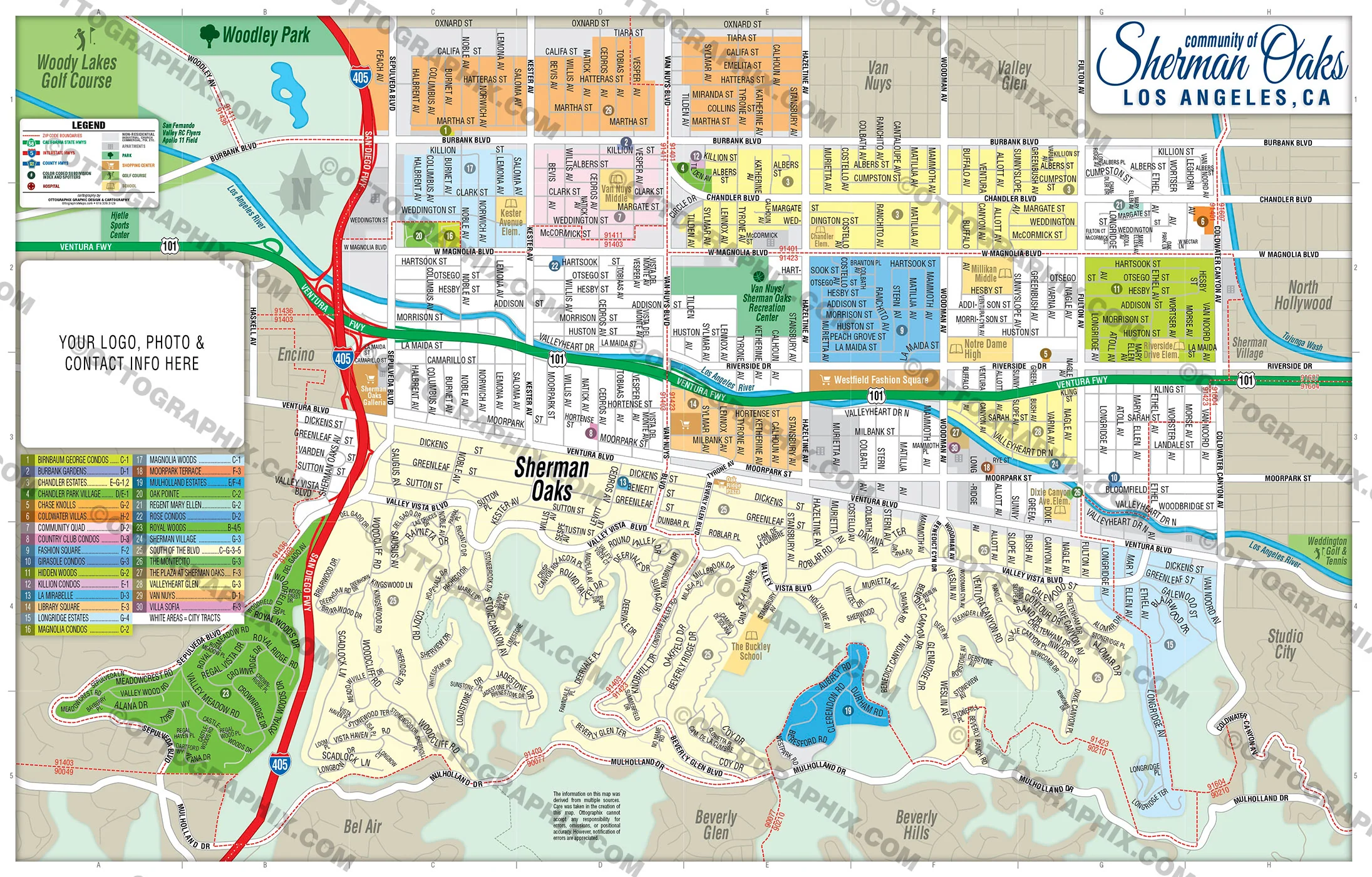
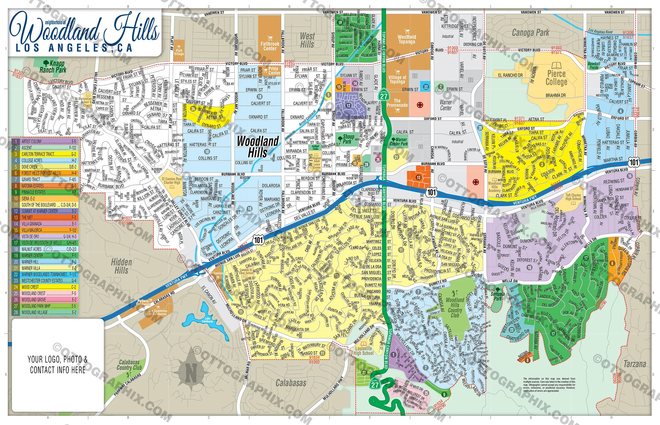
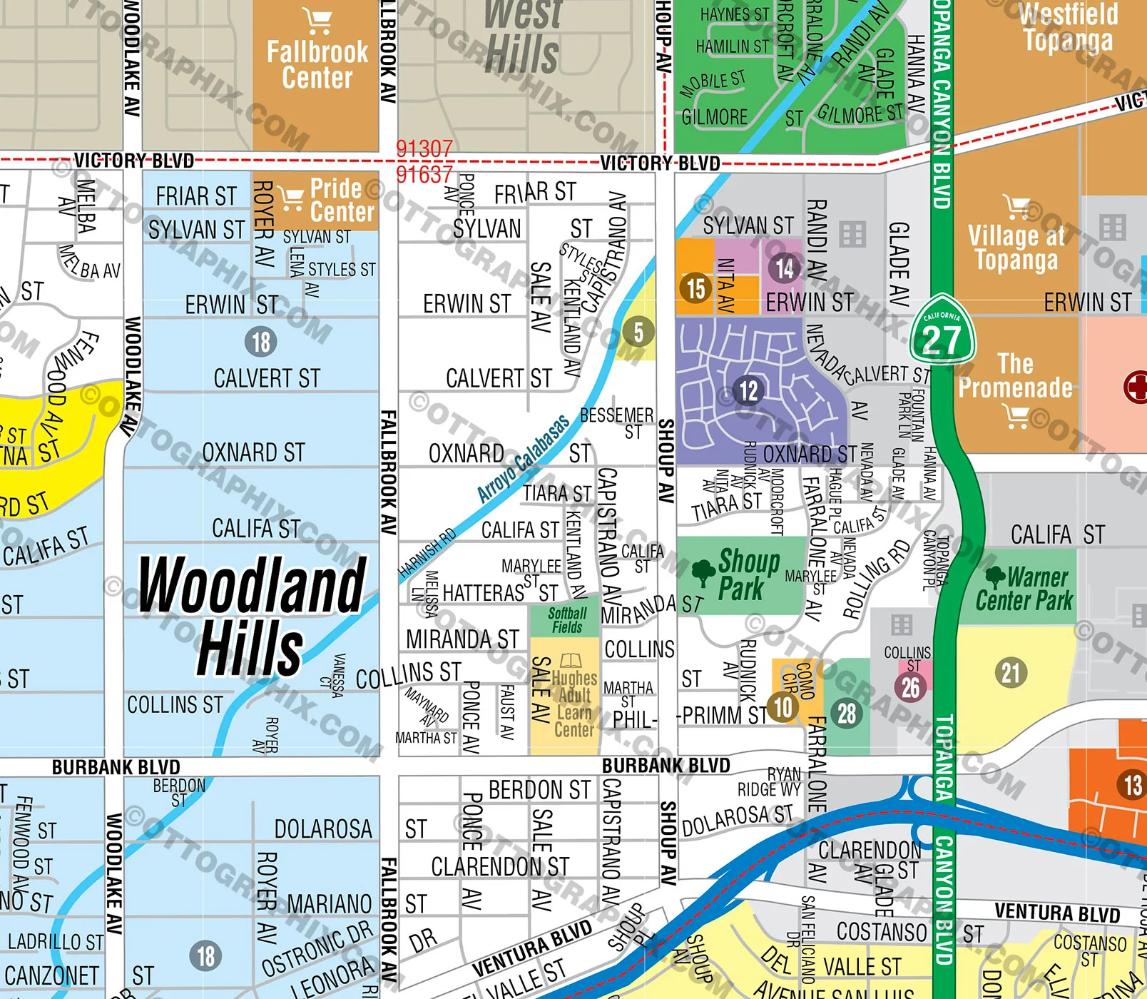
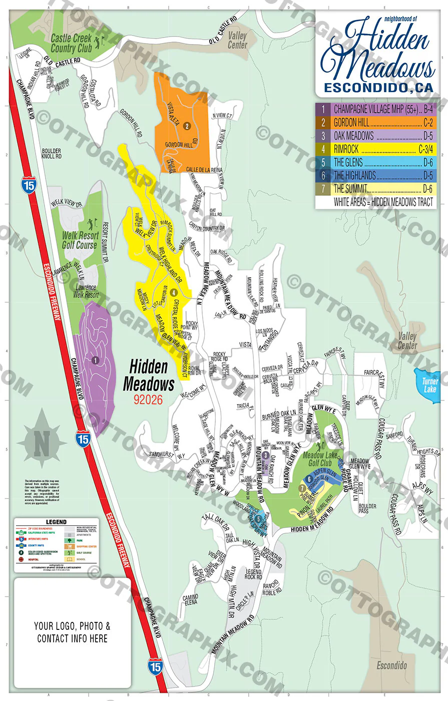
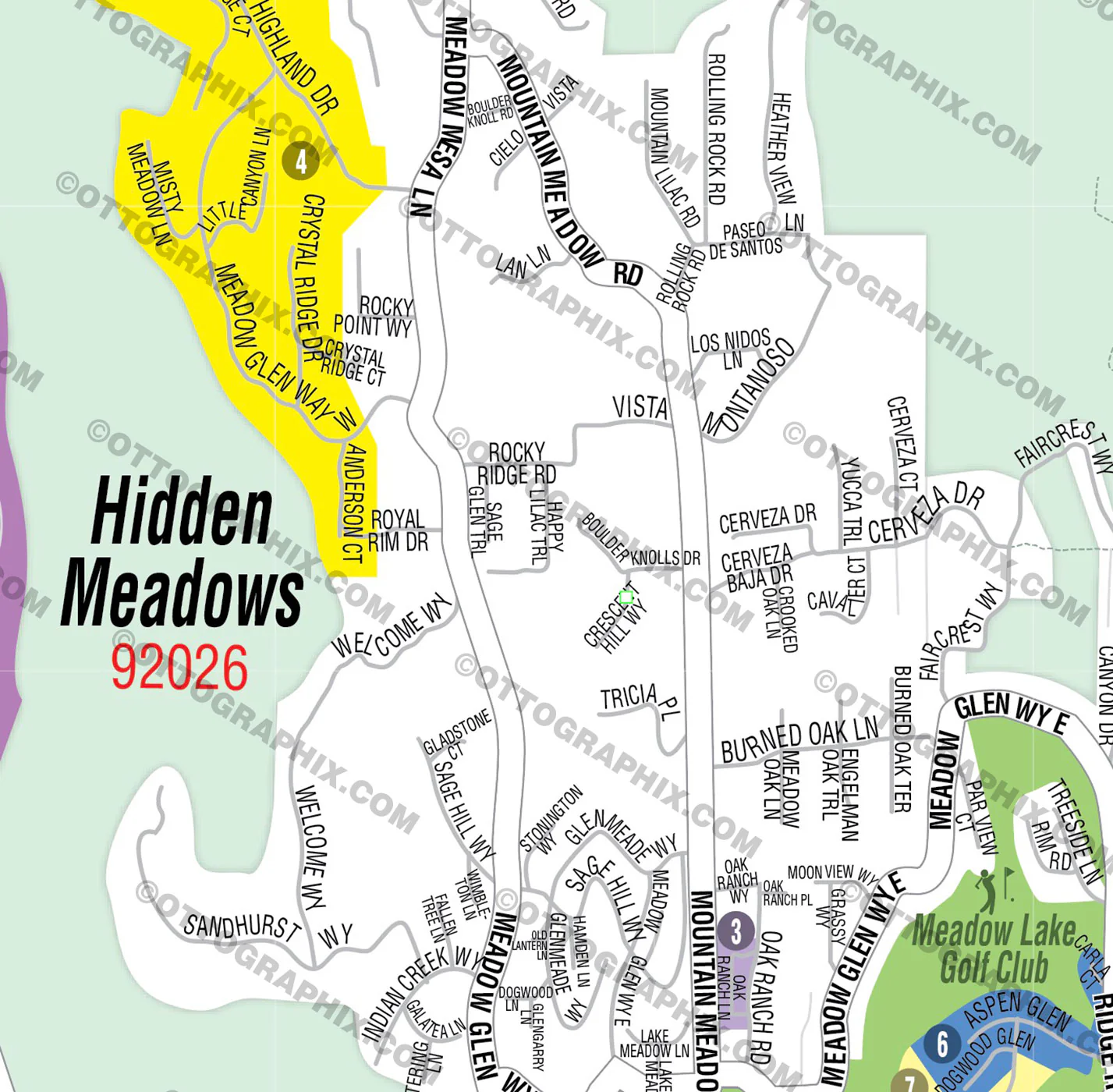
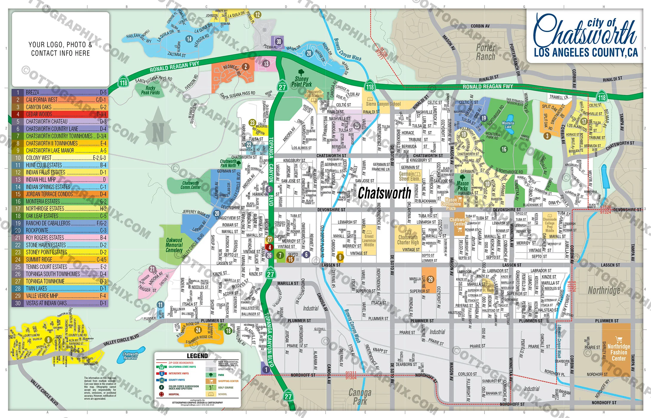
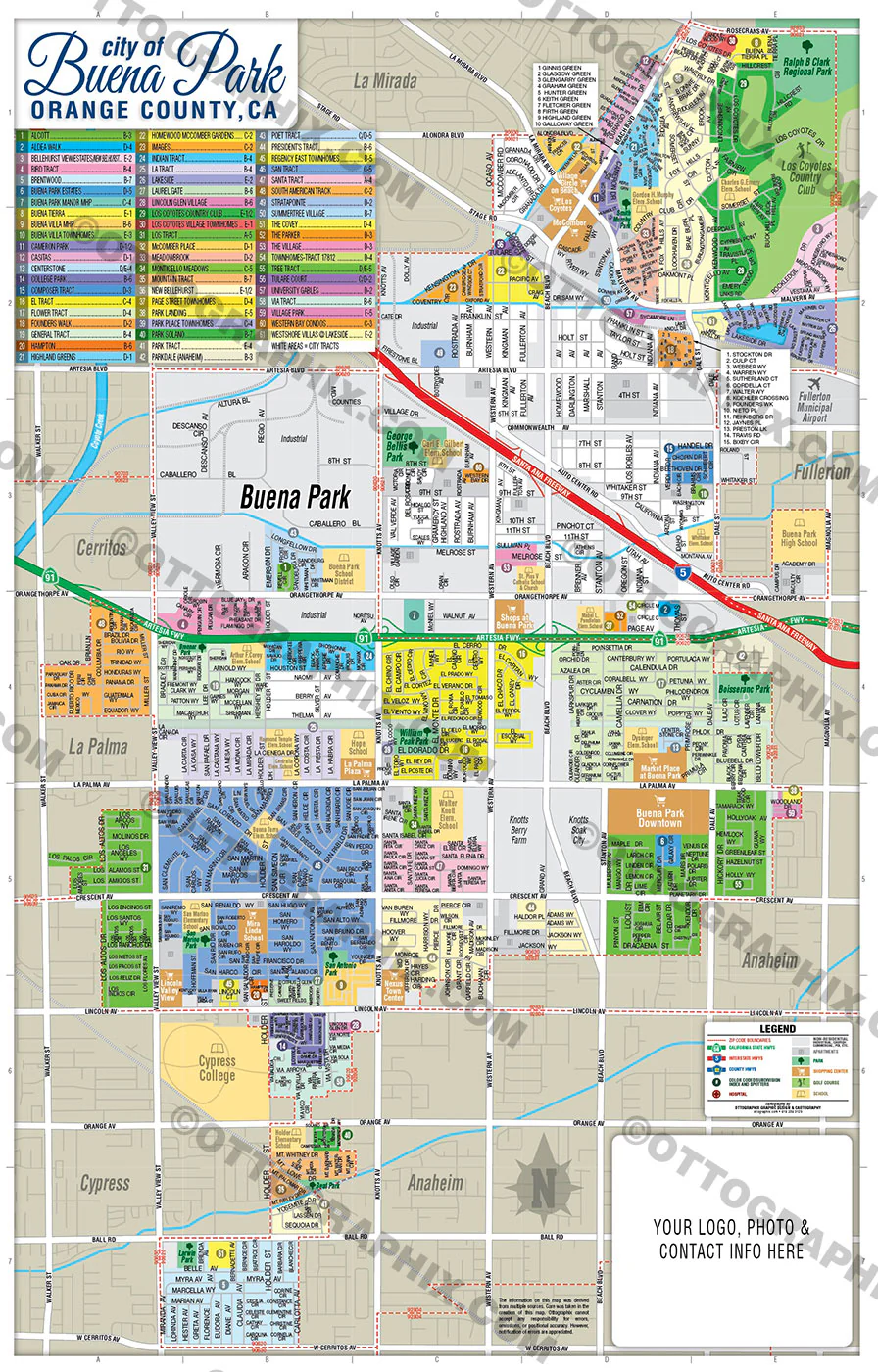
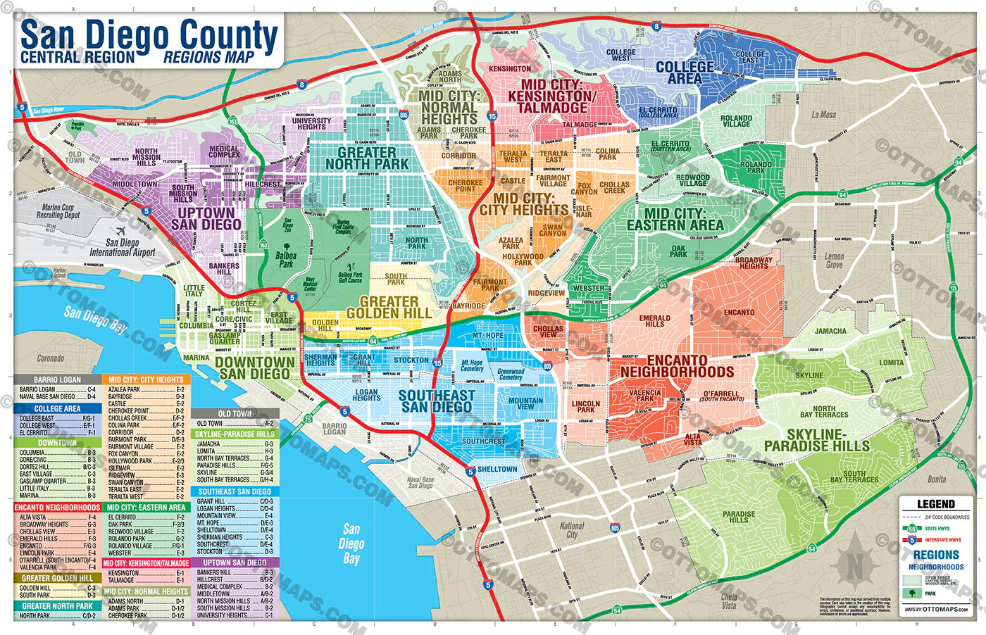
This map is of the San Diego County Central Region. Within it are 12 sub-regions. Within each of those are a number of neighborhoods.
PURCHASE INCLUDES:
- PDF Files - with Company Branding Box and without
- Adobe Illustrator Files and fonts (layered, editable)
- 11”x17” Vector File - enlarged to any size with out loss of quality
- Files are editable with any PDF editor
- Royalty Free / All Reproduction Rights Granted (not for resale)
- Prints not included, request prints here
- No sales tax!
COMMUNITIES:
- ADAMS NORTH
- ADAMS PARK
- ALTA VISTA
- AZALEA PARK
- BANKERS HILL
- BARRIO LOGAN
- BAYRIDGE
- BROADWAY HEIGHTS
- CASTLE
- CHEROKEE PARK
- CHEROKEE POINT
- CHOLLAS CREEK
- CHOLLAS VIEW
- COLINA PARK
- COLLEGE EAST
- COLLEGE WEST
- COLUMBIA
- CORE/CIVIC
- CORRIDOR
- CORTEZ HILL
- EAST VILLAGE
- EL CERRITO
- EL CERRITO
- EMERALD HILLS
- ENCANTO
- ENCANTO NEIGHBORHOODS
- FAIRMONT PARK
- FAIRMONT VILLAGE
- FOX CANYON
- GASLAMP QUARTER
- GOLDEN HILL
- GRANT HILL
- GREATER GOLDEN HILL
- HILLCREST
- HOLLYWOOD PARK
- ISLENAIR
- JAMACHA
- KENSINGTON
- LINCOLN PARK
- LITTLE ITALY
- LOGAN HEIGHTS
- LOMITA
- MARINA
- MEDICAL COMPLEX
- MID CITY: CITY HEIGHTS
- MID CITY: EASTERN AREA
- MID CITY: KENSINGTON/TALMADGE
- MIDDLETOWN
- MOUNTAIN VIEW
- MT. HOPE
- NAVAL BASE SAN DIEGO
- NORTH BAY TERRACES
- NORTH MISSION HILLS
- NORTH PARK
- O’FARRELL (SOUTH ENCANTO)
- OAK PARK
- PARADISE HILLS
- REDWOOD VILLAGE
- RIDGEVIEW
- ROLANDO PARK
- ROLANDO VILLAGE
- SHELLTOWN
- SHERMAN HEIGHTS
- SKYLINE
- SKYLINE-PARADISE HILLS
- SOUTH BAY TERRACES
- SOUTH MISSION HILLS
- SOUTH PARK
- SOUTHCREST
- SOUTHEAST SAN DIEGO
- STOCKTON
- SWAN CANYON
- TALMADGE
- TERALTA EAST
- TERALTA WEST
- UNIVERSITY HEIGHTS
- UPTOWN
- VALENCIA PARK
- WEBSTER
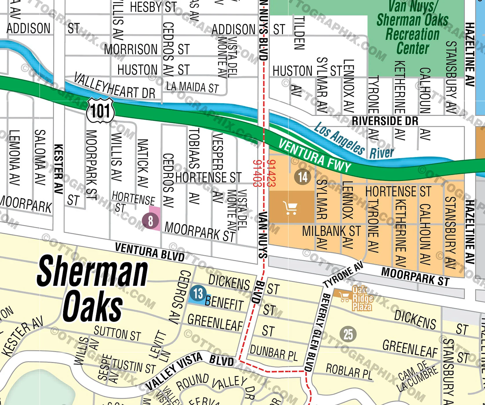
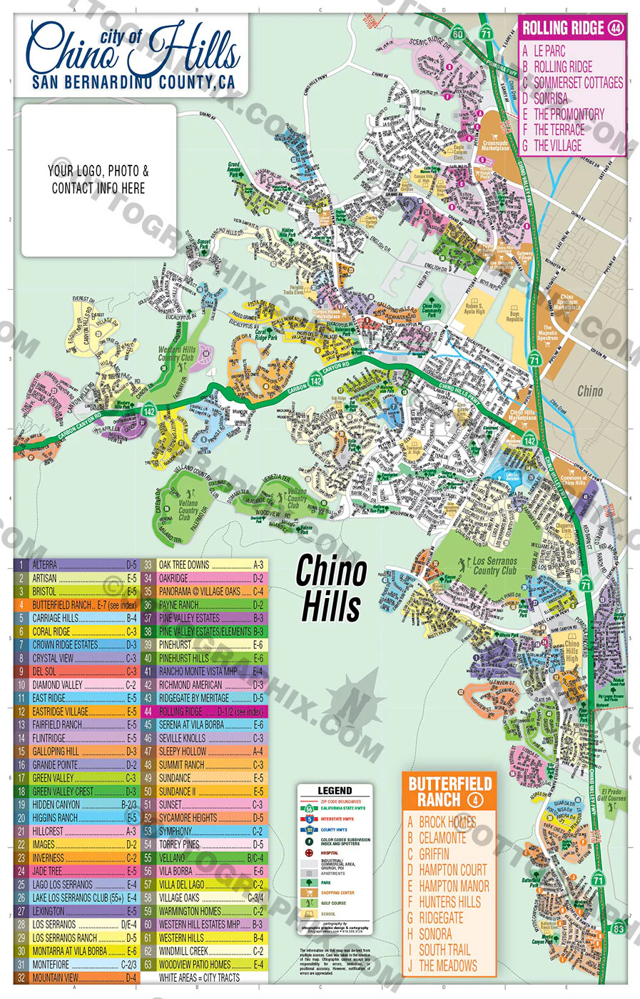
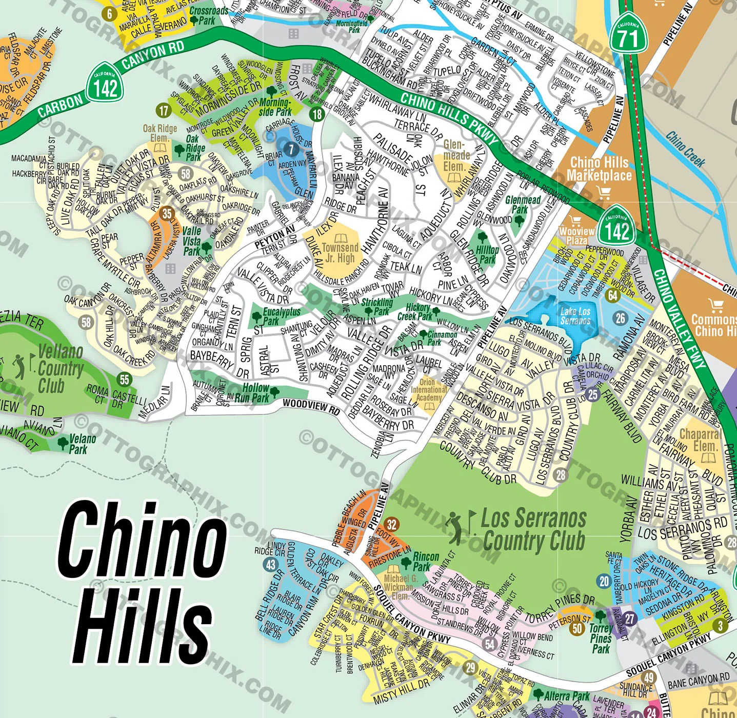
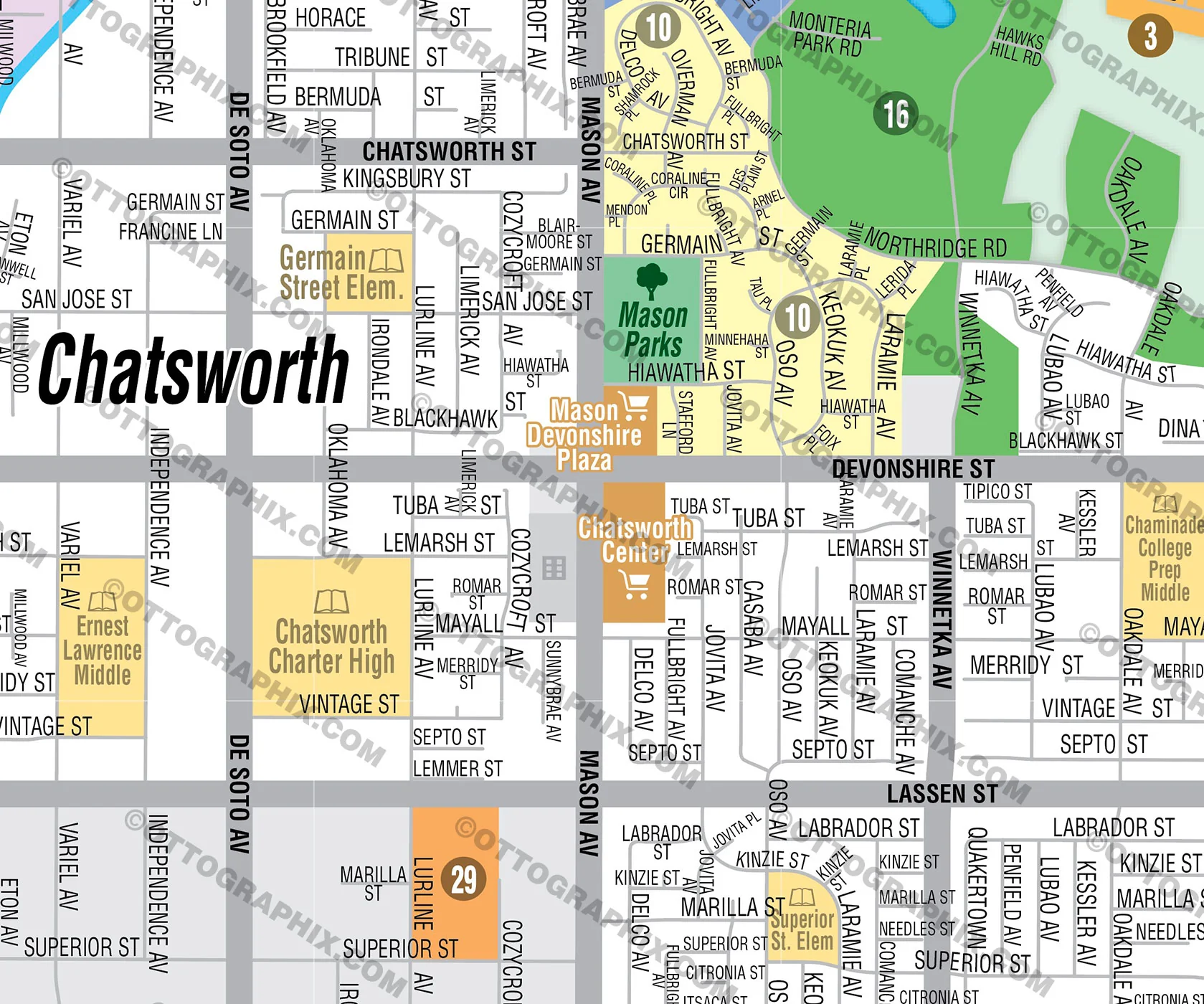
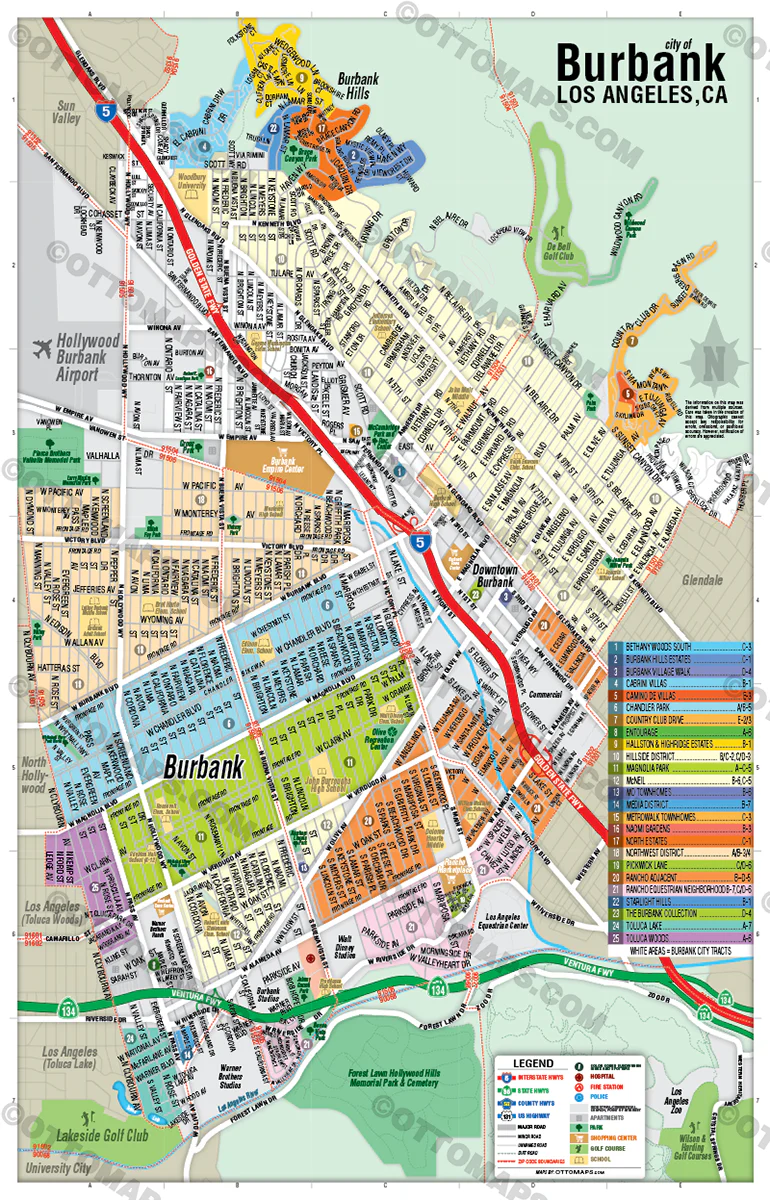
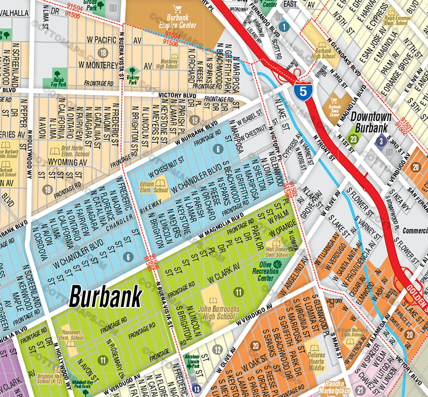
DETAILS:
- Subdivision/Tract Boundaries and Index
- Full Street Detail
- Recreation Centers
- Parks
- Shopping Centers
- Golf Courses
- Schools
RIGHTS:
- • Royalty Free
- • Not for resale
- • All reproduction rights granted
DISCLAIMER:
- The information on this map was derived from multiple sources. Care was taken in the creation of this map. Ottographix cannot accept any responsibility for errors, omissions, or positional accuracy. However, notification of errors are appreciated. If you find a mistake, Ottographix will fix it for no charge. Please contact us and we'll take care of it. https://www.ottographix.com/contact.html, 619.339.3129, [email protected]
- Maps are sold as-is. All necessary files are included for editing
- Additional customization is available from Ottographix at an additional cost. Please contact us for details and a free quote. http://www.ottographix.com/contact.html, 619.339.3129, [email protected]
$28.50
Original: $95.00
-70%San Diego Central Region Map - Regions and Neighborhoods - FILES - PDF and AI, editable, vector, royalty free—
$95.00
$28.50Product Information
Product Information
Shipping & Returns
Shipping & Returns
Description
This map is of the San Diego County Central Region. Within it are 12 sub-regions. Within each of those are a number of neighborhoods.
PURCHASE INCLUDES:
- PDF Files - with Company Branding Box and without
- Adobe Illustrator Files and fonts (layered, editable)
- 11”x17” Vector File - enlarged to any size with out loss of quality
- Files are editable with any PDF editor
- Royalty Free / All Reproduction Rights Granted (not for resale)
- Prints not included, request prints here
- No sales tax!
COMMUNITIES:
- ADAMS NORTH
- ADAMS PARK
- ALTA VISTA
- AZALEA PARK
- BANKERS HILL
- BARRIO LOGAN
- BAYRIDGE
- BROADWAY HEIGHTS
- CASTLE
- CHEROKEE PARK
- CHEROKEE POINT
- CHOLLAS CREEK
- CHOLLAS VIEW
- COLINA PARK
- COLLEGE EAST
- COLLEGE WEST
- COLUMBIA
- CORE/CIVIC
- CORRIDOR
- CORTEZ HILL
- EAST VILLAGE
- EL CERRITO
- EL CERRITO
- EMERALD HILLS
- ENCANTO
- ENCANTO NEIGHBORHOODS
- FAIRMONT PARK
- FAIRMONT VILLAGE
- FOX CANYON
- GASLAMP QUARTER
- GOLDEN HILL
- GRANT HILL
- GREATER GOLDEN HILL
- HILLCREST
- HOLLYWOOD PARK
- ISLENAIR
- JAMACHA
- KENSINGTON
- LINCOLN PARK
- LITTLE ITALY
- LOGAN HEIGHTS
- LOMITA
- MARINA
- MEDICAL COMPLEX
- MID CITY: CITY HEIGHTS
- MID CITY: EASTERN AREA
- MID CITY: KENSINGTON/TALMADGE
- MIDDLETOWN
- MOUNTAIN VIEW
- MT. HOPE
- NAVAL BASE SAN DIEGO
- NORTH BAY TERRACES
- NORTH MISSION HILLS
- NORTH PARK
- O’FARRELL (SOUTH ENCANTO)
- OAK PARK
- PARADISE HILLS
- REDWOOD VILLAGE
- RIDGEVIEW
- ROLANDO PARK
- ROLANDO VILLAGE
- SHELLTOWN
- SHERMAN HEIGHTS
- SKYLINE
- SKYLINE-PARADISE HILLS
- SOUTH BAY TERRACES
- SOUTH MISSION HILLS
- SOUTH PARK
- SOUTHCREST
- SOUTHEAST SAN DIEGO
- STOCKTON
- SWAN CANYON
- TALMADGE
- TERALTA EAST
- TERALTA WEST
- UNIVERSITY HEIGHTS
- UPTOWN
- VALENCIA PARK
- WEBSTER
DETAILS:
- Subdivision/Tract Boundaries and Index
- Full Street Detail
- Recreation Centers
- Parks
- Shopping Centers
- Golf Courses
- Schools
RIGHTS:
- • Royalty Free
- • Not for resale
- • All reproduction rights granted
DISCLAIMER:
- The information on this map was derived from multiple sources. Care was taken in the creation of this map. Ottographix cannot accept any responsibility for errors, omissions, or positional accuracy. However, notification of errors are appreciated. If you find a mistake, Ottographix will fix it for no charge. Please contact us and we'll take care of it. https://www.ottographix.com/contact.html, 619.339.3129, [email protected]
- Maps are sold as-is. All necessary files are included for editing
- Additional customization is available from Ottographix at an additional cost. Please contact us for details and a free quote. http://www.ottographix.com/contact.html, 619.339.3129, [email protected]